
:
3 Great Desert 4WD Tracks from an Updated Hema Maps Guide
Hema Maps’ popular Great Desert Tracks Atlas & Guide — featuring details of 25 epic four-wheel drive adventures across Australia — is being updated and reprinted to include an additional three tracks for those keen to embark on some outback travel.
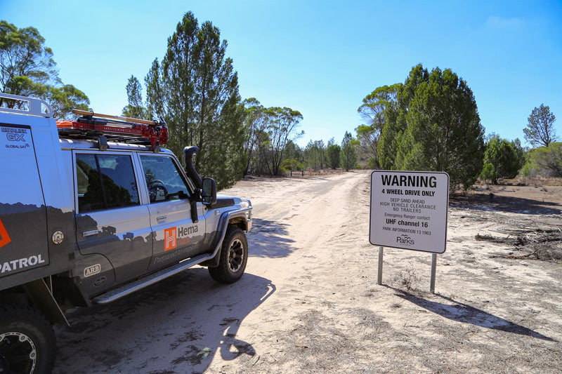
Great Desert Tracks is a comprehensive and informative guide which includes plenty of essential pre-trip reading including general information about Australia's deserts, track descriptions, maps, points of interest and contact details.
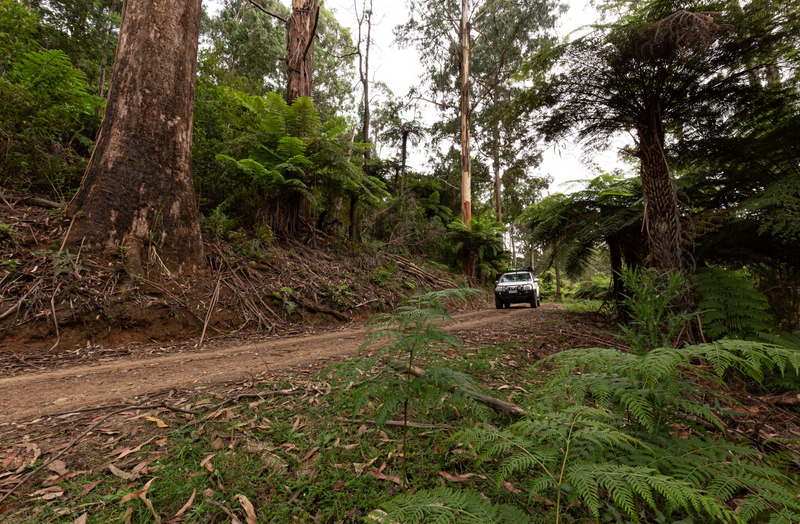
Buntine Highway, WA
An alternate route to the southern Kimberley region, this scenic drive takes you through some remote parts of the Northern Territory.
The drive
The Buntine Highway is a spectacular scenic drive that leads to Halls Creek, in the southern Kimberley. It also has a reputation for being one of the most dangerous roads in Australia. The single-lane bitumen sections are often poorly maintained with several blind corners causing road train rollovers. Being difficult to pass oncoming traffic, especially a couple of road trains, many cattlemen consider it an unsafe road.

It is hard to miss the beginning of the Buntine Highway, with the large memorial dedicated to Noel Buntine, a trucking pioneer who built one of Australia’s largest livestock empires. From the turnoff, the 165km drive to Top Springs is often a dual-lane road with the recent widening of the Buntine Highway in sections. You’ll pass the Delamere Air Weapons Range, a RAAF bombing range. There are recognisable termite mounds, golden grasses and sapling gums along the sides of the road.

A grand dedication to Noel Buntine signals the start of the Buntine Highway
Top Springs Hotel offers accommodation, camping and fuel and a great spot to stop for a counter meal in the back bar. From here it is a 170km drive on a single-lane bitumen road to Kalkarindji (formerly known as Wave Hill). The road is in poor condition, with plenty of potholes, washouts and blind corners. Switching the UHF to channel 40 and performing frequent radio checks is advisable.
Kalkarindji is a place of national significance. In 1966, 200 Gurindji, Mudburra and Warlpiri people walked off Wave Hill Station in a protest over conditions. Led by Vincent Lingiari, it brought about a return of homelands to the Gurindji people in 1974. This was the first legislation that allowed First Nations peoples to claim land titles if they could prove a traditional relationship with the country.
The bitumen ends at Kalkarindji, but the road widens and is regularly graded, especially after rain, so is mostly easy going to the border. There will be corrugations, but not as bad as many other outback roads. Enjoy the scenery south of Kalkarindji with rocky outcrops, escarpments and spinifex. You’ll follow the upper reaches of the Victoria River to the east for a short while before the track veers westward towards the WA/NT border 224km away.
A designated rest stop is located just across the border before you reach the junction with Duncan Road and the end of the Buntine Highway. If you turn right, Duncan Road leads to the Victoria Highway, with Kununurra 325km away. The better option is to turn left and drive the 176km to Halls Creek, it is a stunning drive.

Duncan Road dissects open plains covered with golden Mitchell grass until you drop down the escarpment and enter the Ord River Regeneration Reserve. This reserve was created to help reduce sediment from entering the Ord River. The road then cuts through the Albert Edward Range, with Sawpit Gorge a worthy detour. Palm Springs is a popular swimming hole with its deep water lined with reeds and palms.

Palm Springs
The road deteriorates from here with corrugations making the going tough as the road winds through the range with tight beds, washouts and blind crests until you reach Old Halls Creek. This was once a bustling gold mining town, and the conditions would’ve been harsh.
Prospectors travelled overland from Derby and Wyndham with everything they owned, to try their luck after Charles Hall found a 28-ounce nugget in 1885. This was the first gold discovery in WA and even though it was a short gold rush, the town stayed alive until the highway was built and the town was relocated.
Caroline Pool is another popular swimming hole for the Halls Creek locals although it does dry up if there hasn’t been any rain. China Wall was created by weather eroding the hard rock, leaving the vein of sub-vertical white quartz exposed, it looks amazing. Halls Creek has all the facilities you need and is an ideal place to top up your supplies before you head north to Purnululu or west to Broome.

China Wall
Contact details:
Halls Creek Visitors Centre
P: 08 9168 6262
E: tourism@hcshire.wa.gov.au
Kalkarindji Store & Caravan Park
P: 08 8975 0788
Main Roads Western Australia
P: 138 138
NT Road Report
P: 1800 246 199
Old Town Lodge Camping and Caravan Park
P: 08 9168 8999
Top Springs Hotel
P: 08 8975 0767
Sandover Highway, NT/Qld
This remote desert highway runs between the Plenty Highway and the NT/Qld border and is considered an alternative to the Plenty Highway.
The drive
The Sandover Highway runs for 555km from the Plenty Highway to the NT/Qld border and is used mainly as a thoroughfare for Aboriginal communities and as a stock route for the cattle properties along the track.
This route is a great option if travelling from the Red Centre to Western Queensland. It is a more enjoyable drive than the Plenty Highway which runs further south. The conditions of the track are generally good as the corrugations aren’t as nasty.

The first section is pockmarked clay that can be rough at times, and you may also encounter bulldust, washouts and large stones. The scenery changes on the approach to Mount Skinner and Kunoth Knob, rising above the gidgee, the track skirting the Tomahawk Range. Care is necessary at the floodways and the road becomes rougher, the corrugations bigger as the road follows the powerlines between the Aboriginal communities of Ankerrapw and Ampilatwatja.
The highway narrows from the turnoff to Ampilatwatja and improves for a good distance, allowing constant speeds to be maintained. The track then changes with washouts, dry creek crossings and corrugations as it weaves through a forest of eucalypt. After crossing the river, the track widens, allowing good speeds again and improving the ride over the corrugations. You may encounter occasional deep sand patches that will wash off your momentum. Take care at the cattle grids and reduce your speed as they can be harsh on your suspension.

The highway turns to head due east, and the open plains alternate between dispersed mulga, larger ghost gums and Mitchell grass. The track is maintained along this section, allowing relief from the corrugations. A roadside stop at the junction with the Austral Downs Road heads north to the Barkly Highway, a route some travellers choose to take instead of continuing the short distance to the border.
The track passes Alpurrurulam before reaching Lake Nash Station and the Georgina River crossing to the ‘Welcome to the NT’ sign before entering Queensland and the end of the Sandover Highway.
The road doesn’t end here though, it becomes the Urandangi Road before joining the Camooweal Urandangi Road. From the border to Camooweal, it’s 155km to the Barkly Highway or 214km to Mount Isa via the Old May Downs Road.
Contact details:
Aherrenge Store, Ampilatwatja
P: 08 8956 9885
Arlparra Store
P: 08 8956 9910
Atitjere Store
P: 08 8956 9773
Gemtree Caravan Park
P: 08 8956 9855
Mount Swan Store
P: 08 8956 9582
NT Road Report
P: 1800 246 199
Warte Store, Alpurrurulam
P: 07 4748 4860
Talawana Track, WA
The last of Len Beadell’s desert tracks, the Talawana Track traverses Australia's largest area of desert.

The drive
The Talawana Track crosses a section of the remote Great Sandy Desert in Western Australia and is the final track built by Len Beadell and the Gunbarrel Road Construction Party in 1963. It should never be underestimated with several burnt-out vehicles a testament to the challenges faced by those attempting this track.

Windy Corner is the start of the track and is reached via the Gary Highway and there is a good bush campsite not too far along amongst a copse of trees. The first 45km of the track can be overgrown so expect some bush pinstriping as it enters woodlands and gibbers and the spinifex in the centre of the track is often higher than your bullbar. Upon reaching the Eagle Highway intersection, the track enters sand country.
Flat spinifex plains open up and allow a faster pace, but caution is needed. Burnt-out vehicles litter this section, caused by spinifex getting caught up under the vehicles before catching alight. Don’t be blasé, check underneath your 4WD regularly and your trip won’t be cut short by spinifex related tragedy.
Past Midway Well intersection the spinifex and burnt orange dunes return and the going is reasonable. The track closes in for the next 60km then a short stretch of soft sand before you reach a salt pan that can be treacherous when wet. A diversion track skirts the boggiest sections.

From the junction with the Canning Stock Route, enjoy the views of the ranges for the next 16km where you’ll find the old Canning Stock Route fuel dump that is no longer required, thanks to fuel now available at Kunawarritji near Well 33. A further 22km leads to Georgia Bore, a great bush campsite.

Campsite at Georgia Bore
The track to the Parnngurr turnoff is narrow as it flanks the Harbutt and McKay Ranges, ghost gums show the watercourses and there is more scrub than spinifex. Parnngurr is accessible without needing to contact them first, with fuel and store open Monday to Friday plus Saturday morning. The store has a good range of supplies at a premium rate as is to be expected out here and expect to pay top dollar for fuel, with this being the only fuel stop on Talawana.
The Talawana Track opens up from here and is generally in good condition, although it can become corrugated. Passing through Wells Range, you’ll climb some blind crests on dunes and there are a few tight bends that can catch you out, be alert if towing. Desert oaks are in abundance as you approach the Poison Bush Range then it’s ghost gums and gidgee with a few termite mounds in between the dunes.
The final Len Beadell and Gunbarrel Road Construction Party marker ever imprinted is just behind Old Mia Well, the original barrel still remains with a replica of the original, the last one he scribed on 8 November 1963. A little further along is another point of interest, a solitary rough-leaved ghost gum.

Upon reaching Balfour Downs Road, it’s 116km on a graded and well-maintained dirt road to the bitumen on the Marble Bar Road and 52km for the final leg into Newman.
Contact details:
Department of Biodiversity, Conservation and Attractions (DBCA)
P: 08 9219 9000
E: enquiries@dbca.wa.gov.au
Newman Visitors Centre
P: 08 9175 2888
E: nvctech@newman.org.au
Parnngurr Community Store
P: 08 9176 9009
Kunawarritji Community Store
P: 08 9176 9040
Another great resource
The new edition of Great Desert Tracks Atlas & Guide will be released in early 2024.
Another great resource for those heading into the arid interior is The Great Desert Tracks Map Pack.
This includes Hema's iconic Great Desert Tracks series in a soft and durable map wallet. Each map is waterproof, tear proof and field-checked by the Hema Map Patrol to ensure the accuracy and detail necessary for desert travel. With complete coverage of the outback region of Australia's centre, the Great Desert Tracks Map Pack is the perfect navigation guide for every desert track and journey throughout Australia and is currently available for $59.95 (ordinarily $84.75).
Included in each map pack:
- Great Desert Tracks Central Sheet
- Great Desert Tracks Eastern Sheet
- Great Desert Tracks Western Sheet
- Great Desert Tracks Simpson Desert
- Map Wallet
Next steps
At Hema Maps, we strive to provide the most comprehensive and accurate maps and guides for outdoor enthusiasts looking to explore Australia's natural wonders.
Did you find this information useful? If so, please share it with your fellow explorers. Whether it's by SMS, social media, or email, your friends and fellow adventurers will appreciate the valuable tips and insights we've shared.
Let's work together to make the most of every adventure.
2 comments


Thank you for this article.
Hi do you do a Canning Stock Route map?