
:
Wet season flooding in northern Australia
With the dry season just around the corner, travellers are preparing to head north for winter, so we look at some of the popular destinations for tourists and adventurers and see how they’re faring after one of the wettest wet seasons on record.
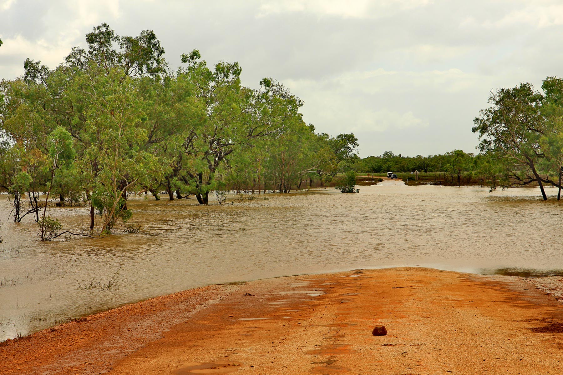
Floods in the Australian outback
Cape York and Far North Queensland
Cyclone Jasper wreaked havoc in Far North Queensland and was the wettest tropical cyclone in Australian history. Jasper made landfall as a category 2 tropical cyclone off the eastern coast of the Cape York Peninsula near Wujal Wujal on 13 December 2023, before weakening into an ex-tropical low and moving overland in a southeasterly direction.
During the height of Jasper rainfall peaked at 2252mm (88.7in) at Bairds near the Daintree River — the equivalent of two years’ rain in just one week. Flights in and out of Cairns Airport were cancelled, residents in the coastal suburbs were rescued from the roofs of their homes and a man died in flood waters. The Insurance Council of Australia estimates the damage from Jasper at $1 million.
Numerous roads were closed after the storm passed, including the Captain Cook Highway between Cairns and Port Douglas. There was significant damage to Cape Tribulation Road and the Bloomfield Track. Some temporary repairs have been put in place, but the extent of the damage means that permanent repairs will not be completed until the end of 2024.
Mareeba-based tour guide Brett Day, who has been conducting tours to Cape York for the past 15 years, said the Cape Tribulation Road is down to a single lane with waits at red lights up to 30 minutes.
The legendary Bloomfield Track — which wends its way through the heart of World Heritage-listed wet tropics rainforest with a visit to Bloomfield Falls, the community of Wujal Wujal and the famous Lion’s Den Hotel before reaching Cooktown — is closed and is unlikely to reopen this year.
While the dry season has not quite started in Far North Queensland, Brett said the monsoonal rains have passed and any rain remaining is coming from the south.
He said the road to Weipa was open and in good condition after being graded. The Batavia Road is currently closed but should reopen soon.
The Cook Shire Council lists the Bamaga Road as being open to high clearance four-wheel drive vehicles.
“No one has been up the Bamaga Road yet so we’re not sure about the conditions, but it’s very likely that the Pajinka Road from Bamaga up to the Tip will be closed for a few more weeks,” Brett said.
The Cook Shire Council provided an update on Cape York Peninsula road conditions on 30 April so head to the website for current information about all local roads.
There are numerous national park closures across Queensland from the Cape to the Gulf to the outback, so check the Department of Environment, Science and Innovation website for park alerts and current information.
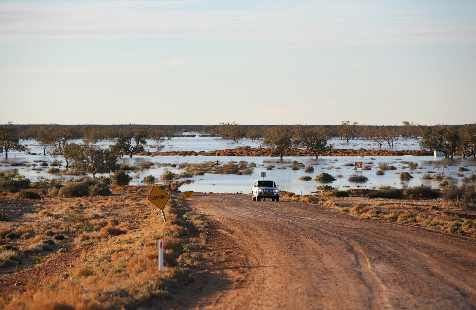
Cooper Creek flooded across the Birdsville Track
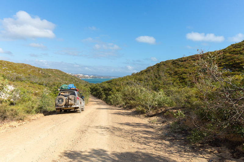
Kimberley, WA
Cyclone Ellie impacted the Kimberley region of Western Australia in December 2022 and January 2023, causing significant damage to infrastructure, including roads and bridges, and leaving many communities isolated and without access to essential services.
The 10km long Willare Crossing of the Fitzroy River on Great Northern Highway has been severely damaged with some of the road being completely washed away.
The Fitzroy River Bridge was significantly damaged along with 500 metres of road east of the townsite, cutting access to Aboriginal communities east of the Fitzroy River as well as the East Kimberley and Northern Territory.
The New Fitzroy River Bridge over the Martuwarra River at Fitzroy Crossing officially opened to traffic in December 2023 more than six months ahead of schedule.
Main Roads WA has been working hard to get the iconic Gibb River Road (GRR) open in time for the dry season and this week announced that the section of the GRR from Mt Barnett to the Kalumburu Road turnoff will reopen on 6 May. This initial stage will permit passage for high clearance four-wheel drives and vehicles under 15 tonnes.
From Sunday 12 May, the section from the Kalumburu Road turnoff to the Pentecost River will reopen, again for high clearance 4WD vehicles and those vehicles weighing under 15T. The road has already opened from Lennard River to Mt Barnett and the Great Northern Highway is open.
Progress is subject to ongoing works and road conditions — it may be dependent on receding water levels at the Mt Barnett river crossing. Keep on eye on the Main Roads WA website for the latest information.
Tourist destinations along the GRR such as Ellenbrae Station and Birdwood Downs Station are preparing to open mid-May and welcome visitors. El Questro is open including El Questro Station, the Swinging Arm Bar, Amalia Gorge, Zebedee Springs, Chamberlain Gorge and Saddleback Lookout.
Major national parks in the Kimberley — which attract thousands of visitors each year — are set to reopen this week after the 2023 floods. Among the most popular are Bell and Windjana Gorges and Tunnel Creek which are looking lush and green. The Danggu Geikie Gorge National Park will remain closed in 2024 because of the severe damage to infrastructure and roads caused by the floods.
Outback Queensland and Northern Territory
Floodwaters from Ex-Tropical Cyclone Kirrily and heavy rainfall near Winton, Qld, resulted in water travelling hundreds of kilometres south through the Channel Country with a major flood passing through Birdsville on the Diamantina River — peaking at 7m — in February and cutting off access to the outback town for weeks.
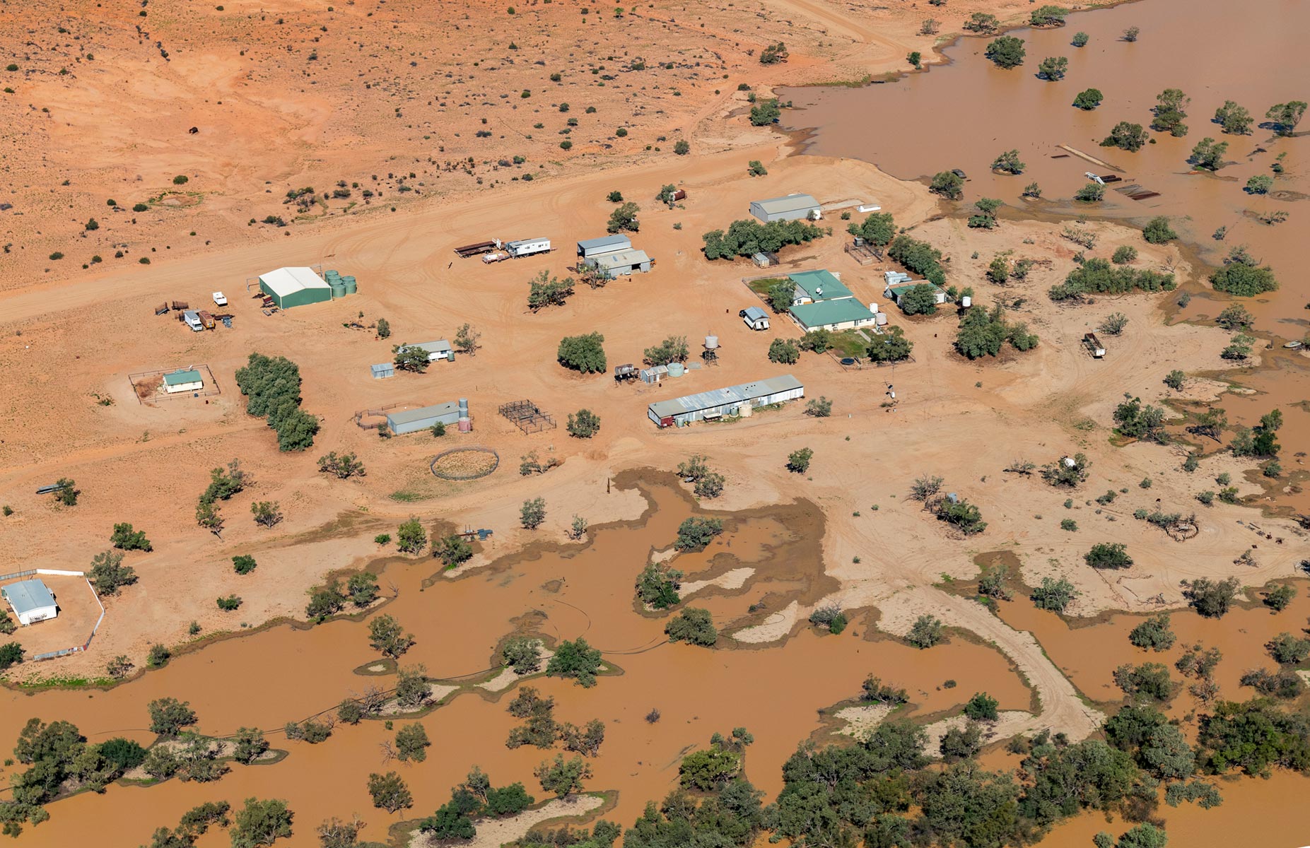
Floods in Birdsville
Floodwaters continued on to the Kati Thanda-Lake Eyre Basin in South Australia, filling the lake and leaving a sea of rejuvenated green floodplain in its wake. A spectacle to witness from the air, tour operators such as Birdsville Aviation are offering daily flights over both Goyder Lagoon and Lake Eyre.
In nearby Munga-Thirri National Park (Simpson Desert) — located within the driest region of the Australian continent — recent rainfall in the Mulligan River Catchment has resulted in the closure of access on the Madigan track east of Camp 20 towards Birdsville. Birdsville is only accessible from the Hay River track/Madigan track via the QAA line. Keep an eye on the website for other flood-related alerts within national parks.
Check road conditions
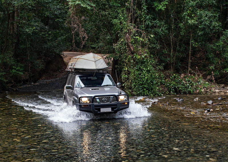
While authorities and local governments typically monitor road conditions throughout the year and issue warnings or advice, travellers planning to visit northern Australia, especially remote areas, should do their own homework and check road conditions and the weather forecast before setting off on their journey.
Importantly, be prepared for changing conditions. Make sure you have the appropriate vehicles, supplies and emergency plans in place, especially when traveling in more isolated regions.
Staying informed
There are many ways to get information about closures and other road conditions while you’re travelling.
Local radio stations and news outlets — such as the ABC in rural areas — often broadcast updates on road closures, flood warnings and travel conditions, especially during severe weather events. Tuning in to local radio stations or checking news websites and social media channels can provide timely information.
Local councils in rural areas are often responsible for the maintenance of local roads and their websites and social media pages will have information about road closures, roadworks and alternate routes.
State Government transport departments or road authorities provide up-to-date information on main roads that fall in their jurisdiction via websites, social media channels or through dedicated hotlines.
Smartphone apps
There are several smartphone apps available that provide real-time updates on regular and extreme weather conditions including the Bureau of Meteorology (BOM) and Weatherzone.
The Northern Territory Government has developed its own app for travellers to get real-time information about road closures and conditions. The Road Report NT mobile app for both Apple and Android phones can be downloaded from the App store or wherever you get your apps.
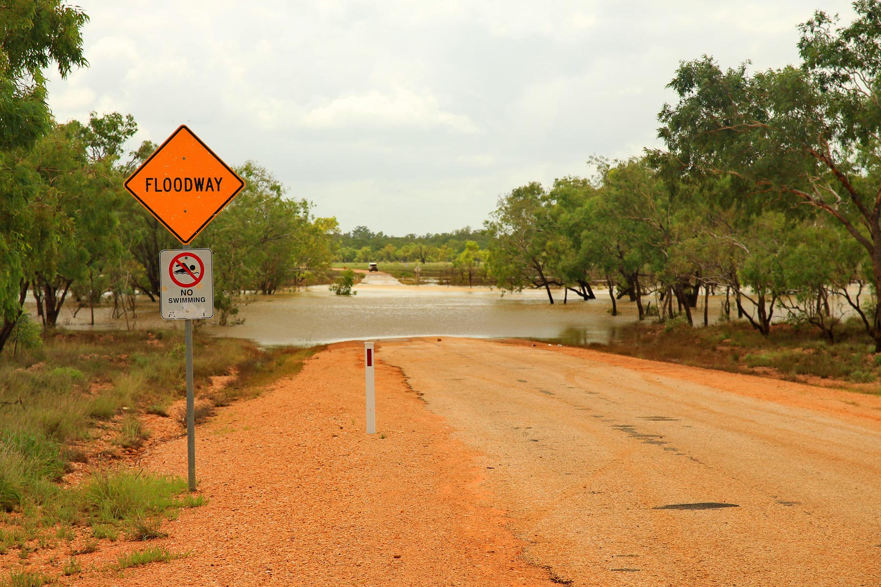
Floodway in South Australia
Online maps and navigation apps
There have been an alarming number of instances in recent times of travellers becoming lost in the outback because they have used Google or other online applications as navigation tools.
If you are planning to travel into remote areas of Australia, a reliable navigation system such as the Hema HX-2+ GPS Navigator is essential. Leveraging the iconic Hema Maps and remote guidance powered by HemaX Digital, the HX-2+ GPS Navigator includes 150,000 points of interest (POI) such as campsites, caravan parks, hotels, motels, rest areas, boat ramps, fuel stops, tourist spots, post offices and more.
Visitor information centres
Visitor information centres in popular destinations may also have information on road closures and travel advisories. If they don’t have the information, they will certainly be able to direct you to the correct source of information. Most visitor information centres have very comprehensive websites for further information.
Road signs and notices
Authorities typically post signage along major highways and roads to alert travellers to closures, detours or other hazards. Paying attention to road signs and notices while travelling can help avoid unexpected delays or disruptions. Entering a road that is marked as closed can incur a steep fine in some states.
Travellers should remain vigilant and flexible when travelling during the wet season in northern Australia, as road conditions can change rapidly due to weather events. It’s essential to stay informed, heed warnings and advisories from authorities, and adjust travel plans accordingly to ensure safety.
Handy Telephone Numbers
- SA Government: 1300 361 033 (Automated Service)
- Qld Traffic: 13 19 40
- Main Roads WA: 138 138
- Road Report NT: 1800 246 199
Floods in the Australian outback
Next steps
At Hema Maps, we strive to provide the most comprehensive and accurate maps and guides for outdoor enthusiasts looking to explore Australia's natural wonders.
Did you find this information useful? If so, please share it with your fellow explorers. Whether it's by SMS, social media, or email, your friends and fellow adventurers will appreciate the valuable tips and insights we've shared.
Let's work together to make the most of every adventure.


0 comments