
A guide to Palmer River Goldfields — Cape York, Qld
In the dusty highlands of the Palmer River Goldfields region, adventurous four-wheel drivers can experience one of Cape York’s most challenging tracks which straddles the Great Dividing Range: the Old Coach Road.
Maps and navigation
- Cape York Adventure Pack
- Cape York Atlas & Guide
- Cape York map
- Hema HX-2 Navigator
- Hema HX-2+ Navigator
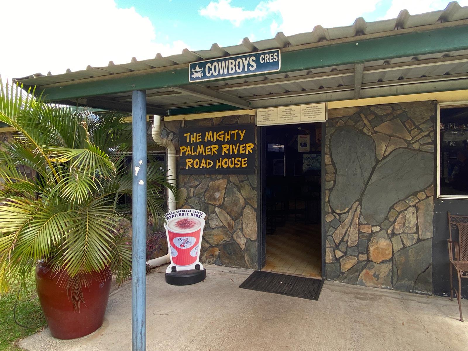
The first of many roadhouses at Palmer River
Essential information
Grading: Low range gearing and high ground clearance
Time: Two days
Distance: 154km, Laura to Peninsula Developmental Road
Longest drive without fuel: 171km, Laura to Palmer River Roadhouse
Best time of year: The dry season (May–October)
Warnings: Extremely steep-banked dry creek crossings. Rough road conditions until Maytown. Fossicking is prohibited in the Palmer Goldfield Resources Reserve. Stay on signposted tracks and avoid any side tracks that lead to mining leases.
Permits and fees: Camping in Palmer Goldfield Resources Reserve requires a permit. Campers must by an e-permit before arriving: book online via book online via the Queensland National Parks Booking Service or phone 13 QGOV (13 74 68). Fees apply.
Facilities: Laura and Palmer River Roadhouse
Camping:
- Basic camping at the North Palmer River camping area. Camping permits and fees apply.
- Jowalbinna Rock Art Safari Camp. Camping fees apply.
Important contacts:
Queensland Parks and Wildlife Service (QPWS) Cairns
P: 07 4222 5303
W: parks.des.qld.gov.au
Cook Shire Council
P: 07 4082 0500
E: mail@cook.qld.gov.au
W: cook.qld.gov.au
Jowalbinna Rock Art Safari Camp
P: 07 4060 3236
W: facebook.com/JowalbinnaBushCamp
The track
The beginning of this track is on the Peninsula Development Road (PDR), just north of Laura on the left about 100m past the Rinyirru (Lakefield) National Park (CYPAL) turnoff. A large sign for Jowalbinna marks the turn.
The first 32km of the track is easy going until you get to the Jowalbinna turnoff. About three quarters of the way to Jowalbinna you cross the Little Laura River, which is a shallow, rocky-bottomed ford.
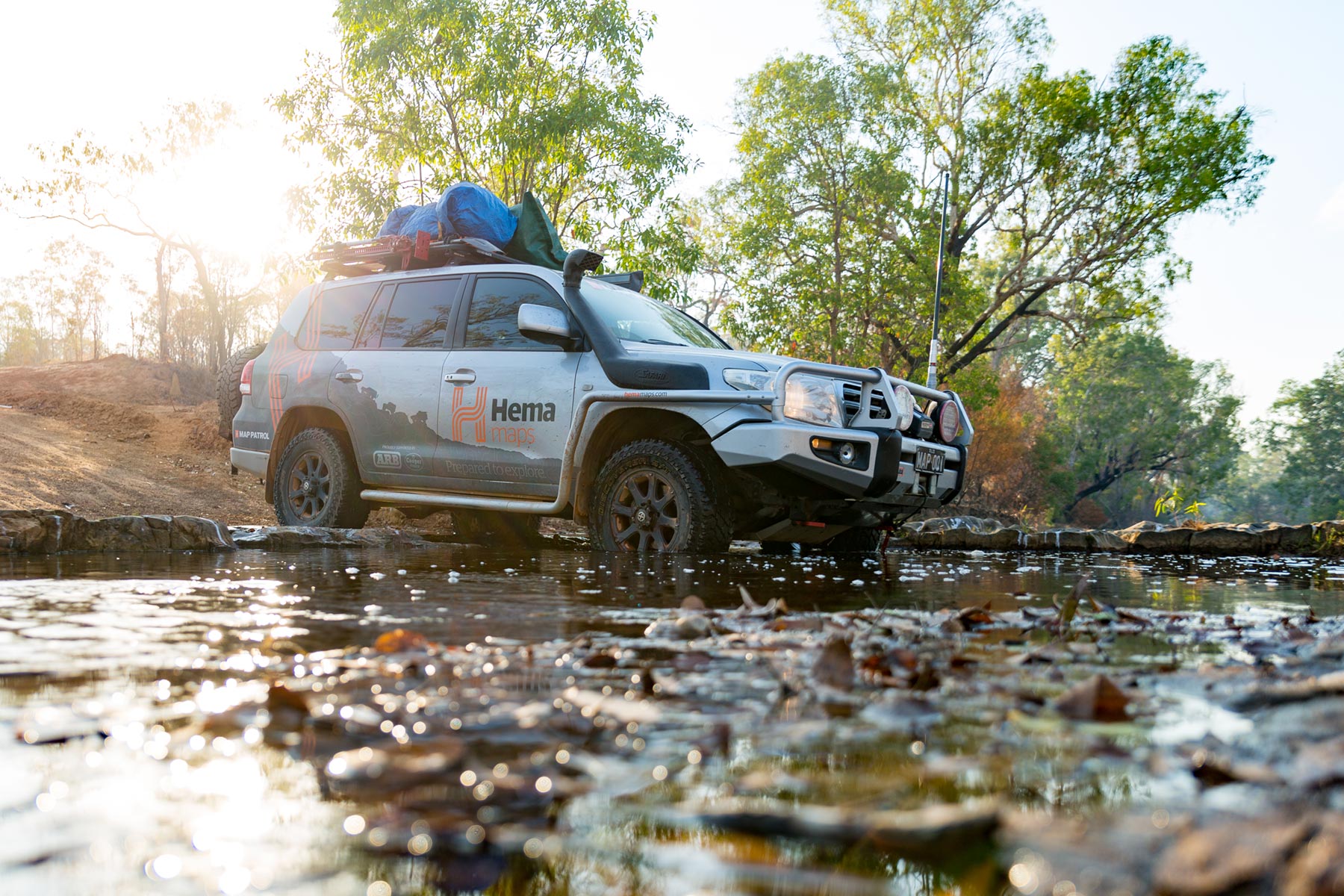
The creek crossing at Little Laura River
At the junction of the Shepherd Creek with the Little Laura River, the road deteriorates into a very rough track until Maytown.
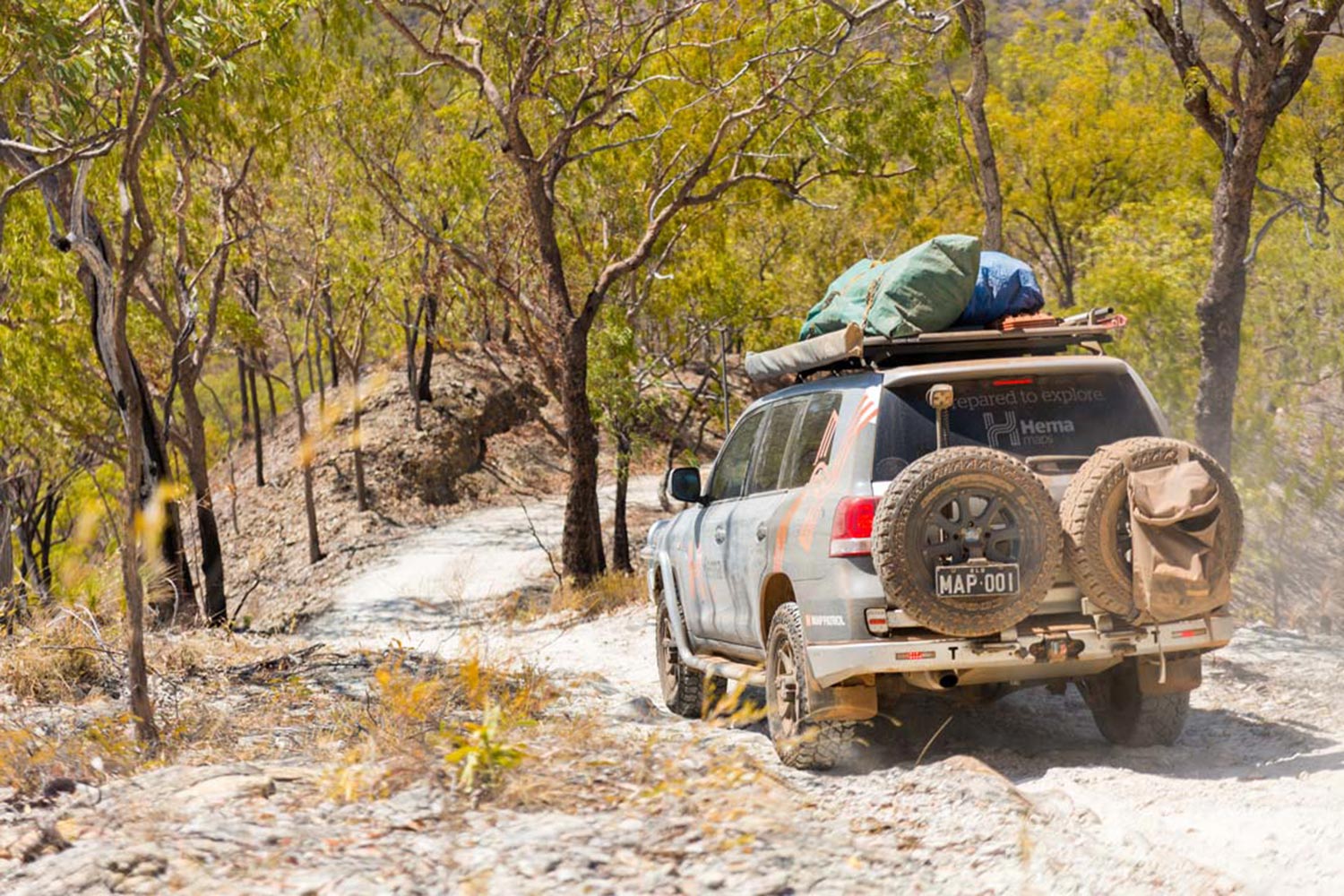
The Old Coach Road is now the most difficult track on the Cape York Peninsula. It’s definitely not for the inexperienced, but for a very competent four wheel-driver with a very capable vehicle fitted with a winch and at least one diff lock. Don’t go it alone — you'll need a spotter to guide you over massive, steep, eroded, tyre-blocking ascents and once over the range, similarly challenging descents.
This is a track with a real risk of panel damage or rollover, so make sure you have a satellite phone or personal locator beacon (PLB). The ability to pick the right line and an appreciation of subtle throttle pressure is critical and concentration is demanded 100 per cent of the time. It’s relentless, with one obstacle immediately followed by another, and once you reach the top, the track winds between fallen trees. It’s 56km of hard going, and this section of the route will take you at least seven hours.
There are signs that keep you on the right track towards Maytown if you are coming from the north. There isn’t as much help if you do this track from the south.
When you get to the monument at Maytown, the track south requires a left turn, which takes you past more ruins and old cobblestones still visible on the trackside and down to the Palmer River crossing. A sign advises that crossing not advised, but the crossing is shallow and rocky.
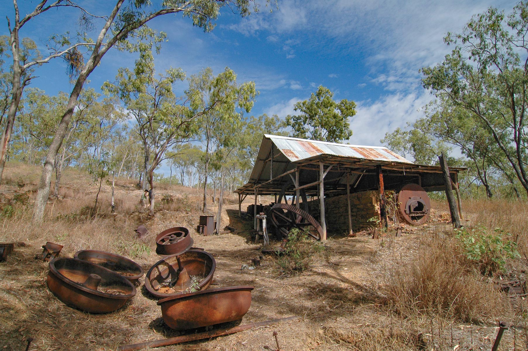
Palmer River Goldfields Maytown - Comet Mine
The excellent graded 79km road out to the Peninsula Development Road is an easy run with a few steep sections, and the Palmer River Roadhouse is only 17km north of its exit on the PDR. This track is an epic journey, reminiscent of what more of the roads up here were like for a long time, and a time capsule in its own right.
Things to do
Near Maytown there are numerous mining camps and batteries, including the Queen of the North Mine and Battery, the Ida Mine and the Mabel Louise and Comet Batteries. The Comet Battery has much of the original equipment in relatively good condition. Aside from building foundations and the remnants of stone curbs in Maytown, not much has survived of this ghost town. It once hosted 12 hotels, several Chinese general stores, three bakers, a butcher, lemonade factory, chemist and surgeon. The telegraph poles that have survived still have little corrugated A-frame roofs to protect them from rot.
If gold-mining history isn’t your thing, Jowalbinna offers guided tours to the large Quinkan rock art site in the region – with 4WD and walking tours available.
Gold, gold, gold
The Palmer River Goldfield was the largest and best producing alluvial goldfield in Australia, and it isn’t a stretch to say that this field was essentially responsible for the growth of places like Cooktown, Port Douglas and Cairns. Some estimates place the weight of gold retrieved from this area in excess of 1.25 million ounces — a figure worth several billion dollars in today’s currency. The field is still producing for small leases in the area.
There was a dark side to this boom, though. The Cape is an unforgiving country, and there are tales of men stranded on one side of swollen rivers, their pockets loaded with gold nuggets, starving to death while merchants across the river waited with food they could not sell.
Keep exploring
Once you’ve ticked this challenging 4WD track off your bucket list, how about exploring these other popular (and just as tough) tracks while you’re up north:
Some other popular (and challenging) tracks to explore while up north:
- The Old Telegraph Track North and South
These tracks will lead you into some of the most beautiful and remote areas of Far North Queensland, via river crossings and corrugated dirt roads, various camping areas, through a tropical rainforest or two and much more.
Next steps
At Hema Maps, we strive to provide the most comprehensive and accurate maps and guides for outdoor enthusiasts looking to explore Australia's natural wonders.
Did you find this information useful? If so, please share it with your fellow explorers. Whether it's by sms, social media, or email, your friends and fellow adventurers will appreciate the valuable tips and insights we've shared.


0 comments