
Track Review - Gibb River Road - The Kimberley
Hema HX-1 Navigator
Considering its large size, sparse population and rugged topography, it’s not surprising that the Kimberley has a limited road network. Vast areas have no vehicle access whatsoever, and what there is tends to be rough. There are just two through routes – the sealed Great Northern Hwy and the mostly-unsealed Gibb River Road. The former skirts the rugged hinterland and links the region’s six towns, while the latter cuts across the sparsely populated central plateau. This configuration allows for a round trip with little backtracking apart from detours off the main routes.
Here are our favourite top off-road tracks in the Kimberley:
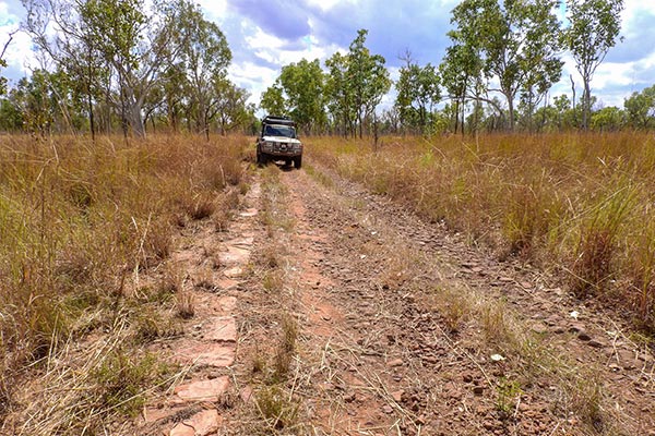
Gibb River Road
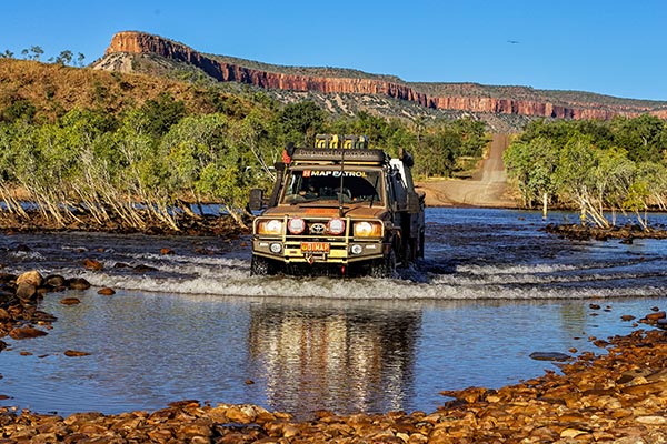 The Gibb River Road is one of Australia's classic outback 4WD treks, and the last wild frontier in Western Australia. By taking on numerous side tracks, you will discover a plethora of waterfalls, gorges, bush campsites and remote homesteads not seen from the main road.
Tanami Track
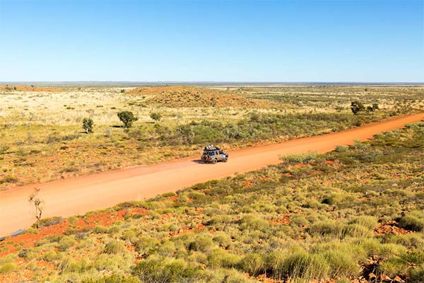 The main purpose of the Tanami Road for travellers is a short cut from Alice Springs to the Kimberley but is an off-road experience in itself. Strong tyres and suspension are essential as severe corrugations can be expected before the grader comes through.
Mitchell Plateau Track
 This 4WD track provides the only land access to Mitchell Falls, the main attraction in the 115,300ha Mitchell River National Park. It terminates at the top of the Mitchell Plateau at the Mitchell Falls camping area.
Spring Creek Track
 Vehicle access to Purnululu is via the Spring Creek Track, a flat-bladed road that careful driving owing to numerous rock bars, steep slopes, narrow blind crests, bulldust holes and other hazards.
Old Halls Creek Road
 This generally rocky 4WD track is 13km long and goes through surprisingly dense boab woodlands. There are a few rocky creek crossings and washaways but nothing a medium clearance 4WD couldn’t undertake.
Wolfe Creek Crater Drive
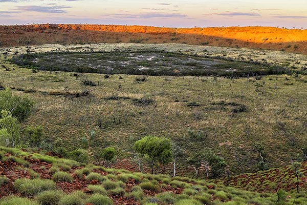 Sitting just off the Tanami Track, the drive to the Wolfe Creek Crater is a corrugated track that requires a 4WD to traverse. What awaits is one of the world's largest meteorite impact site, and a memorable sight for visitors to this special place.
Cape Leveque
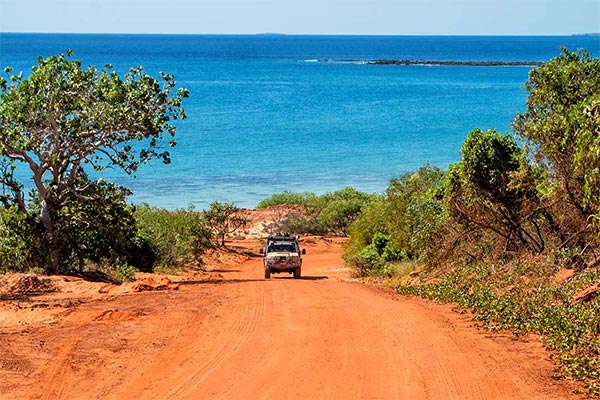 A remote peninsula in the Kimberley's far north, Cape Leveque is home to dusty red tracks, deserted beaches and some amazing spots to camp and fish. Whether you're mixing it with tourists at Kooljaman or on your own at a bush camp at James Price Point, a journey to the cape's pindan cliffs is an entrancing experience.
Cable Beach Drive
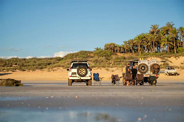 Cable Beach is perhaps Australia's best-known four-wheel drive access beach. Watch the sunset over the Indian Ocean with residents and visitors alike, or drive up the 22km up the beach to experience some pristine Kimberley coastline.
Saddleback Ridge Track
 This track to Saddleback Ridge Lookout near the main resort has steep slopes of moderate difficulty and is not recommended for novices. Be there late afternoon for the best photographs.
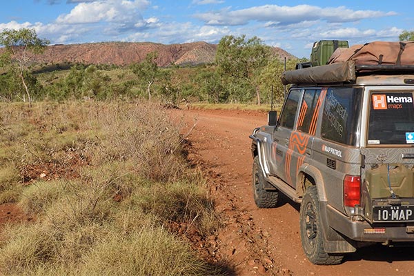
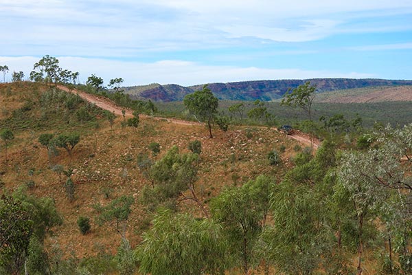
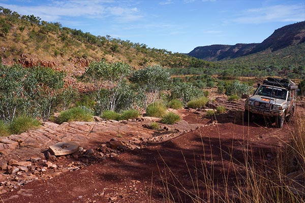
Karunjie Track
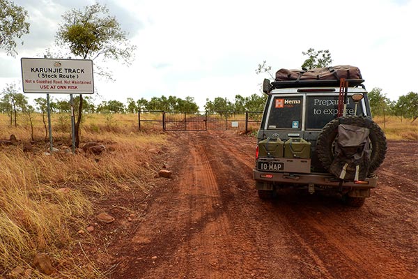 Skirts the spectacular Cockburn Range and makes a good day’s outing with plenty to see en route. This track takes you past Diggers Rest Station, on the range’s northern side, where you can camp.
Explosion Gorge Track, El Questro
 The 20km 4WD track to Explosion Gorge with its impressive red cliffs is also worth doing. Explosion Gorge is on the Chamberlain River at the northern end of the remarkable Elgee Cliffs.
Northern Coastal Track

This normally rough dirt road opens up a string of coastal camping and fishing spots that stretches 45km from Willie Creek in the south to the Coulomb Point Nature Reserve in the north.
Parry Creek Road
During the Wet all roads are closed for varying periods because of flooding. It’s always a good idea to carry extra food and drinking water if touring at this time. As well, all roads – including the highway and Gibb River Rd – have low-level stream crossings whose status can change rapidly, with water levels being down one minute and up the next.
During the Dry the condition of a typical unsealed road is largely a function of the time since it was last graded and the volume of traffic using it. Generally the more important ones aren’t too bad – although what constitutes a ‘good’ or ‘bad’ road is often a subjective thing depending on the driver’s level of experience with Outback roads. One person’s doddle can be another’s nightmare!
While we don’t advocate speeding on dirt roads, it is possible to drive too slowly on corrugated surfaces. At 20km/h the vibrations can seem like they’re shaking the vehicle and its contents to pieces, whereas at 70km/h the ride may be quite tolerable. Be careful, though, as the line between danger and comfort can be a fine one.
Bulldust holes are another hazard worth singling out. These are particularly common in flood-plain areas and hitting one at speed can be catastrophic. As they’re filled with dust, you won’t know how deep a hole is until you’ve fallen into it. Often the sun can be at an angle such that you won’t see a bulldust hole until it’s too late. Fitting a snorkel to the air intake will help ensure the engine’s longevity by feeding it dust-free air.
Road Reports
To find out the current status of Kimberley roads, ring Main Roads WA’s statewide road condition report on Ph 138 138, 1800 013 314.


0 comments