
:
Cape Melville
Featuring some challenging four-wheel driving and the prospect of a remote beach at its end makes the trip through Cape Melville a classic Cape York sojourn.
Essential information
| Grading | Difficult. Low range gearing and high ground clearance: take traction aids and recovery gear |
|---|---|
| Time | Minimum four days |
| Distance | 233km, Cooktown to Cape Melville; 376km, Cooktown to Bathurst Head |
| Longest drive without fuel |
414km, Endeavour Falls Tourist Park return; 446km, Endeavour Falls Tourist Park to Laura (via Kalpowar); 471km, Endeavour Falls Tourist Park to Musgrave Roadhouse (via Kalpowar) |
| Best time of year | Dry season (May – October): the Park is closed for the Wet season, which is usually from Dec 1 to July 31 although dates vary depending on weather and road conditions. |
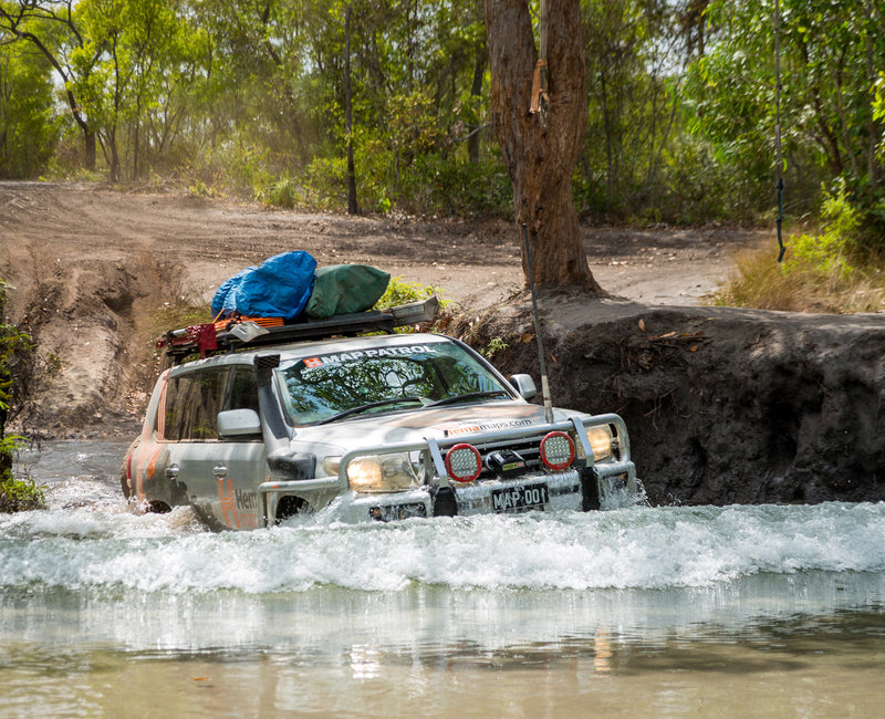
| Warnings | This is a remote area with no supplies or reliable water sources. When possible travel with another vehicle. Access may be closed after heavy rain, so always check the latest conditions before leaving Cooktown. Satellite phones are essential as there is no mobile phone coverage, and personal locator beacons are recommended. Crocodiles occur in all rivers, creeks, swamps, wetlands and waterholes, as well as along beaches so always be very watchful. Keep campsites well above the highwater mark to avoid crocodiles, and on the sand to avoid damaging beachfront vegetation. |
| Permits and fees | Camping in the National Park requires a permit. Campers must buy an e-permit before arriving: book online at www.qld.gov.au/camping or phone 13 QGOV (13 74 68). |
| Facilities | Cooktown, Endeavour Falls Tourist Park, Laura, Musgrave Roadhouse |
| Important contacts | QPWS Cairns Ph (07) 4222 5303; Cook Shire Council Ph (07) 4069 5444, www.cook.qld.gov.au |
The track
 The run from Cooktown to Battle Camp Rd is mainly bitumen and good dirt, running alongside the fish-rich Endeavour River.
North of Endeavour Falls Tourist Park is the Battle Camp Rd turnoff, and 8km later is the turnoff for the Starcke-Wakooka Rd.
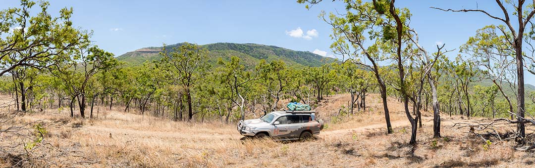
From pastoral land, the track drops into overhung rainforest and several dry creek crossings: a distant range looks over the track.
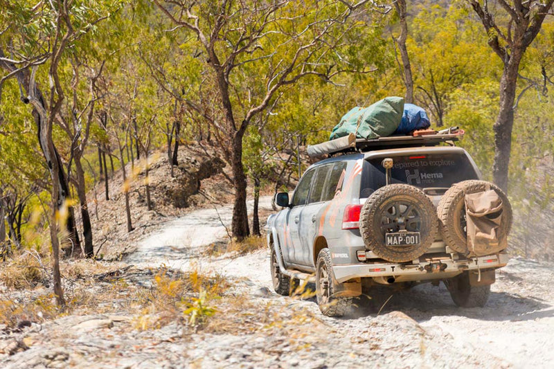
Further on the track opens up again into plantations and orchards, and this far it is a wide, graded dirt road. Soon after Starcke Station the track turns into a real 4WD track, with washouts, bulldust, potholes and stone shelves. This is low-range driving, first and second gears, so make sure you allow a couple of days to get to Cape Melville – it usually takes 11 to 12 hours.
 Tall grass lines the track, growing in the centre of the track higher than the bonnet through the old station property. An old shed and Telstra satellite dish sit derelict on the side of the track and then you pass a dilapidated old windmill in a stunning red grass expanse, with the Altanmoui Range towering powder blue in the distance.
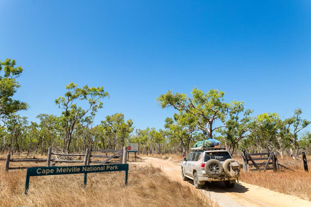
At the old Wakooka Station ruins there are a couple of 40 Series Land Cruiser wrecks and the turnoff for Cape Melville National Park. While the track gets better than the last 70km, there are still plenty of washouts and sandy corrugations.
Several small rises give glimpses north to the brooding Melville Range that defines this coastline. The track slowly gets sandier as you get closer to the beach and the savannah becomes paperbark swamp and inland salt marsh.
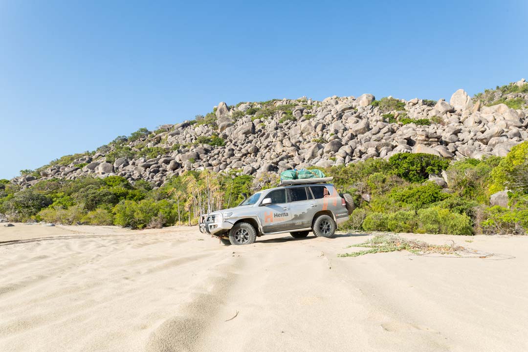
Finally, the track opens right up with beautiful views of the Melville Range where they spill into the sea at Cape Melville: a conglomeration of massive boulders, like Black Mountain to the south.
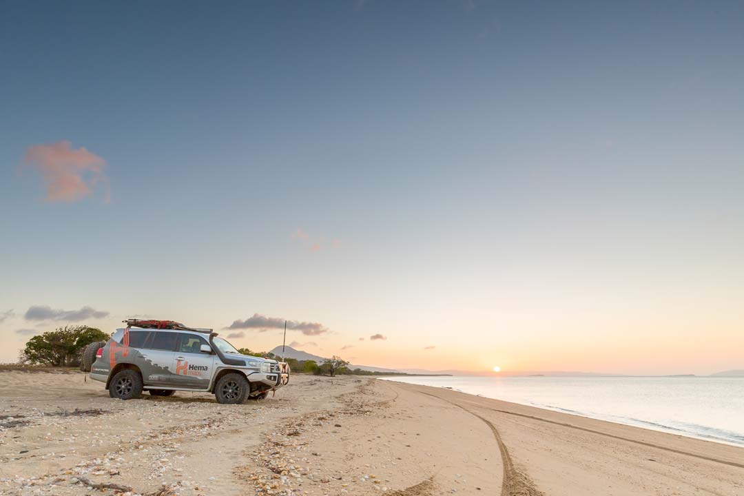
The beach is a long white crescent teeming with baitfish, a metre from the sand and thin limestone rock outcrops. The Flinders group of islands float on the horizon like an armada, the sun setting behind them in a wash of colour.
Behind the beach is a wide expanse of salt mudflats, but between them and the beach is a rise of coarse sand and shady red condo trees providing shady campsites. Beware of the territorial green ants that protect these trees.
An easy return route is to the east from Wakooka, via Kalpowar Crossing and Rinyirru (Lakefield) National Park.
Continuing to Bathurst Head, you’ll head east from Wakooka Station. The track crosses several small creeks, including Barramundi Creek, then there is a turnoff for Bathurst Head and Combe Point. The track is in great condition most of the way, graded east of Wakooka and smooth with some washouts after the turnoff.
Following the wide Marrett River north, the track is sandy and flat and the river widens quickly into broad marshes. There are numerous fishing and camping spots along the track here on the river, and lilly lagoons full of geese and ducks.
As you near the coast the track skirts massive dry mudflats. Early in the season these can be very boggy, even if the surface looks dry, so it pays to take the high track around them.
The best camping at Bathurst Head is on the west-facing beach south of the head and up over the escarpment behind this beach to Combe Point.
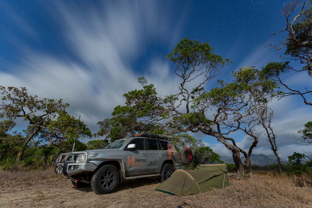
Camping
Ninian Bay Camping Area, Cape Melville National Park
Bathurst Bay Camping Areas (Granite, Oystercatcher, Wongai & Crocodile), Cape Melville National Park
Things to do
The old pastoral ruins that dot the track belie a different kind of life for this country, but now it is all Aboriginal land or national park.
When the fishing is on at the Cape, the Cape Melville coast is one of the most vibrant and rich fishing beaches in the country.
While fishing is allowed in all creeks and rivers in the Park, there are plenty of crocodiles around. The waters surrounding the Park are part of the Great Barrier Reef World Heritage Area and there are restrictions on certain types of fishing in particular areas. Maps are available from the Parks office or The Lure Shop in Cooktown.


0 comments